Minutemen to Bruce Freeman Path (USA-MA: Boston to Lowell)

Close to the city, close to nature!

Overview

Ideal for people of all skill levels!

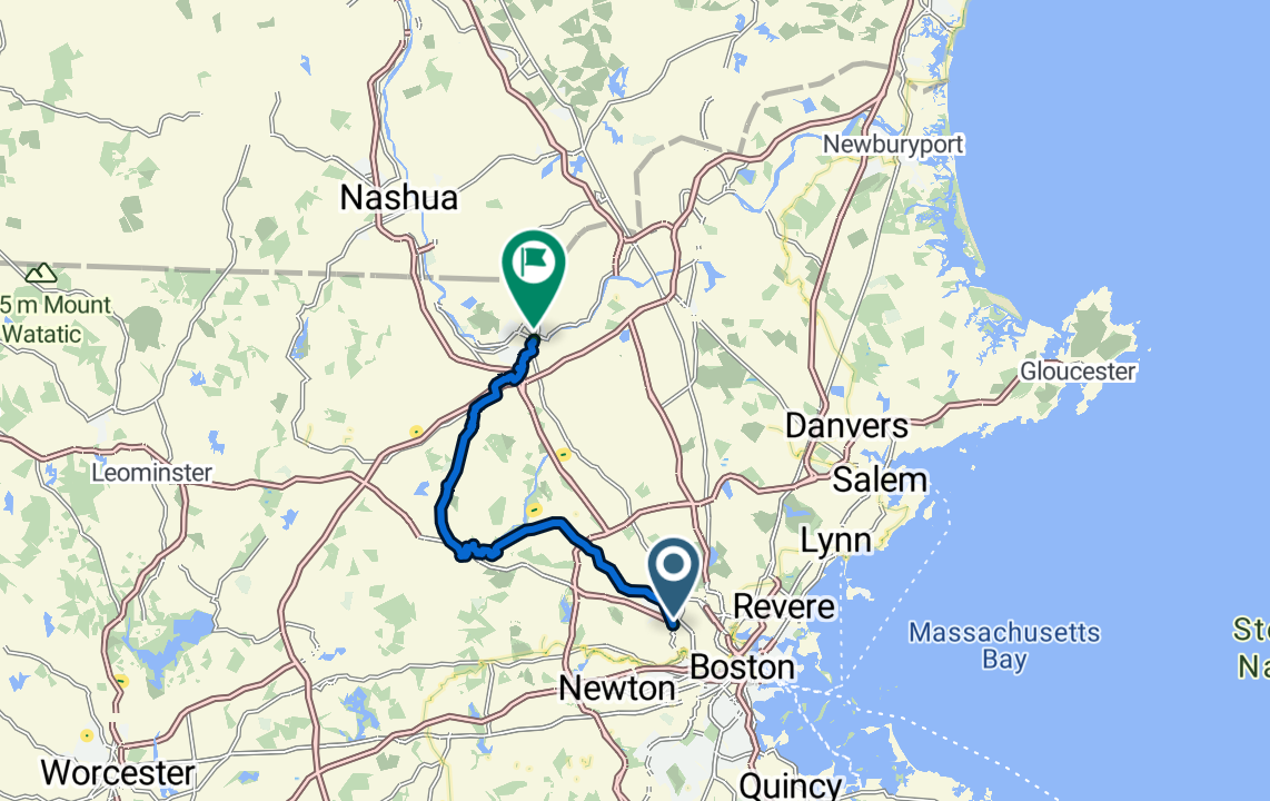
This is a great path for people in the Boston-Metro Area.  It's an awesome way to feel tucked away in nature without ever being too far from civilization.  Public transport is also available on both ends of the trail, making this a logistically very doable trail for a great ride.

This trail connects 2 separate rail trails:

  • Minutemen: Due to the proximity to Boston, the Minutemen is a very well-traveled bike path emanating from the edge of Cambridge, MA.  Despite being crowded, you'll love the tree-lined path filled with all sorts of people; be it families, commuters or fitness-junkies. This trail itself runs about 15 miles from Cambridge to Concord, MA, with the entirety on Car-Free bike paths. You will pass thru several small historic towns along the way so never too far from resources. Walden Pond!!! If you're a fan of Theroux, you'll love this trail as it passes thru the town of Concord which was made famous by the famous book Walden, published in 1854.
  • Bruce Freeman: There is about a 2 mile break in the trail where you will have to share the road with cars between the Minuteman and Bruce Freeman trail. Once you're on the Bruce Freeman, you'll love the flowing nature of the trail.  Along the way, you'll pass through wooded areas, wetlands, open fields, and small-town centers.  Again, the entirety of this trail is Car-Free.

Difficulty Explained:

Hands down, this is an easy pathway.  Mostly on car-free paths with modest elevation gains.  There are several exit points along the way if you cannot finish.  Both end points are well-connected to public transit making logistics a non-issue.

Notable towns along the path:

  • Cambridge, MA
  • Arlington, MA
  • Lexington, MA
  • Bedford, MA
  • Concord, MA

Interactive map showing the complete route. Green marker indicates start point, red marker shows the end point.

Local Businesses

Food/Drink

Kickstand Cafe (Arlington, MA): Cute cafe which caters to cyclists along the Minutemen. Directly off the trail. 

Craft Food Halls – Revolution Hall (Lexington, MA): Brewery with good food and great outdoor seating. Directly off the trail. 

Debra’s Natural Gourmet (Concord, MA): Nice grocery store with healthy grab n go meals. . Directly off the trail. 

Rapscallion Table & Tap (Acton, MA): Homey gastropub featuring a range of house-brewed beers & comfort eats in an old-school farmhouse.. 500ft east of trail. 

Lodging
Suggest Local Businesses
Resources

Conte’s Bike Shop (Lexington, MA): Full service bike shop. Directly off the trail. 

Bikeway Source (Bedford, MA): Great bike shop with affordable prices. Directly off the trail. 

The Bike Shop (Chelmsford, MA): Full service bike shop. Directly off the trail. 

Notable Sites + Highlights

  • Walden Pond(Concord): If you're a fan of Theroux, you'll love this trail as it passes thru the town of Concord which was made famous by the famous book Walden, published in 1854.

Logistics

Transportation To and From

  • To Start: The route starts on the western edge of Cambridge which is easily accessible by the Alewife Station (Red Line).
    • If going by car, parking in Cambridge is notoriously hard.  Alewife train station does have a garage which is a little pricey. Another possibility could be to start in Arlington which is a few miles into the route and parking is more readily available.
  • To Finish: Lowell is a medium-size city in MA which is connected to the MBTA regional train line.  There are also several bus lines and parking is very easy.
  • From Finish to Start: The MBTA train line will essentially take you to the start of the route in Cambridge (Porter Square) which is why this is listed as a point-point route
  • In Between: If you want or need to end the ride early, there is an exit point at Concord where you can take an MBTA train back to Cambridge.

Recommended Gear

  • Bike: Any bike should suffice for this trail as it is predominantly on asphalt.
  • Clothing: This is a short enough ride that if you check the weather ahead you can plan accordingly

Navigation

  • Signage: Navigating this route is very straightforward and ample signage and mileposts along the route.

Resources Along the Way

  • Lodging: This trail is likely not long enough to warrant an overnight stay.
  • Food & Water: There are towns roughly every 5-10 miles with resources.
  • Cell Signal: Signal is perfect the entire length

Tips

  • Best Seasons: Early spring through Late fall (March-end–November) for best weather and road conditions.
  • Emergency Number (USA/Canada): 911 (+1 country code).

Important Warnings

Subway lines within Boston city limits have some restrictions on when bikes can travel on them. This changes often but for now: 10 AM–4 PM and after 7 PM weekdays, all day weekends

Route Details

Distance(Miles)

40 mi

Duration

1-2 Days

Elevation(ft)

150

Countries

United States

Start/End Points

Lowell, MA -> Cambridge, MA

Route Format

Point to Point

Bike Lane Types

Bike Path
90%
Separated Bike Lane
5%
Shared Lane
5%

Tags

External Resources

Terms of Use: Cycling any route featured on this website is done entirely at your own risk. Before setting out, always check current route conditions, and any public or private land closures. While riding, obey all applicable laws, rules, and land-use restrictions, and ensure you carry appropriate safety and navigation equipment. The information provided on this site including route descriptions, maps,  and recommendations is intended solely as a planning and inspirational resource and should be used in conjunction with your own research, judgment, and due diligence. The accuracy, completeness, and suitability of the information, and the judgment of the author(s) cannot be guaranteed. Spokenlocal.com, its partners, affiliates, and contributors assume no responsibility or liability for personal injury, property damage, or any other incidents that may occur while riding or following any route featured on this website.