Overview

Awesome Trail for beginners, families, and especially those loving gorgeous pastoral scenery of northern VT!!

What is the Trail

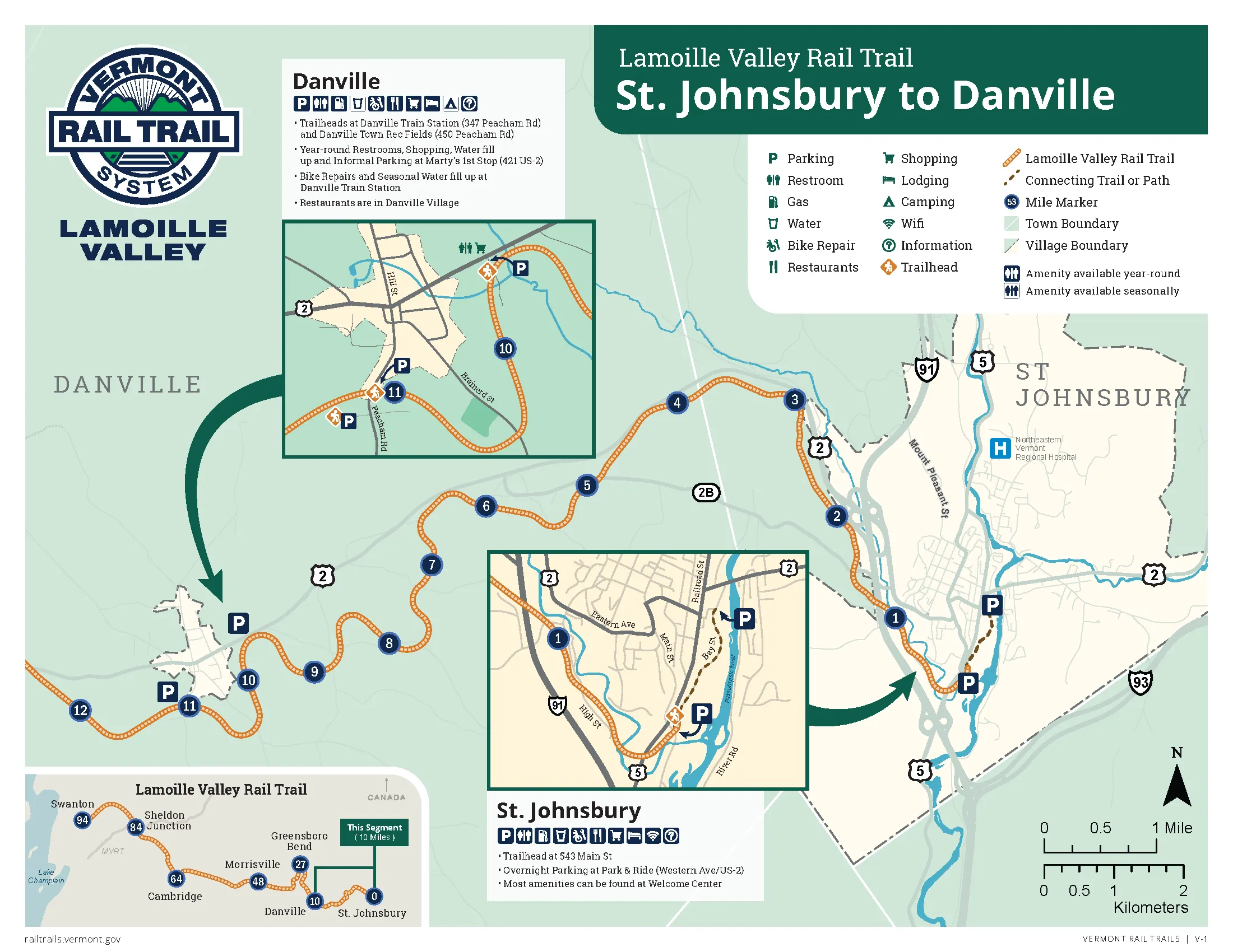
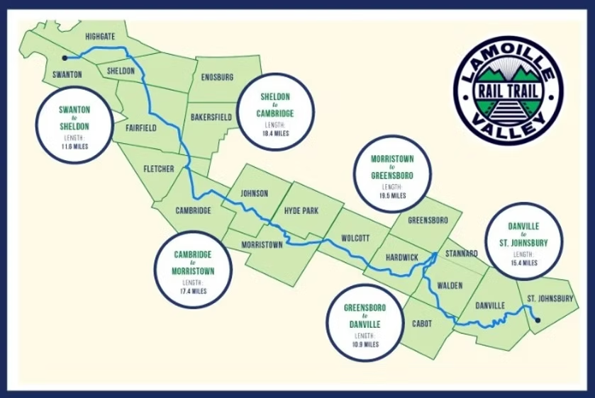
The Lamoille Valley Rail Trail (LVRT) is a 93-mile, car-free, multi-use corridor stretching across northern Vermont from St. Johnsbury to Swanton. It follows the route of the former Lamoille Valley Railroad.

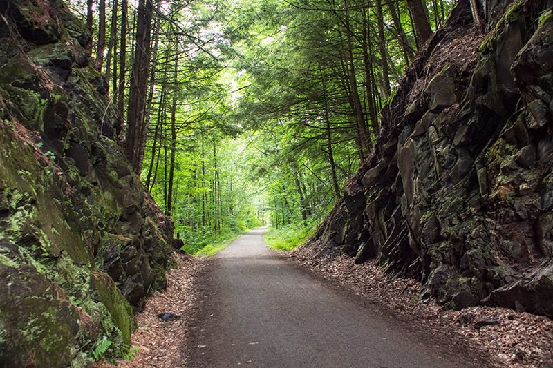
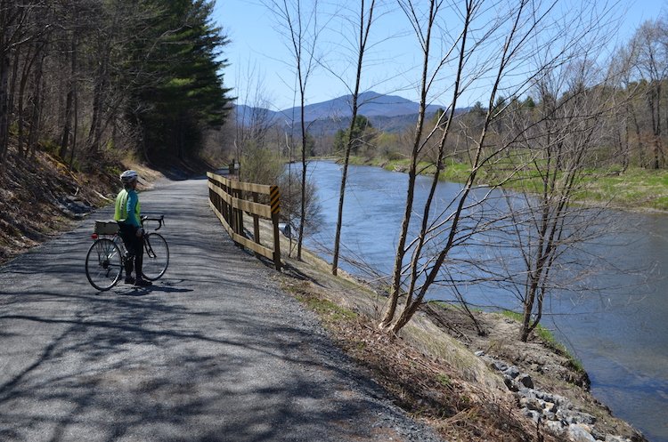
The trail surface is a 10-foot wide, compacted crushed stone path, with gentle grades (≤ 3%).  It’s open year-round for a variety of non-motorized uses: biking, walking, hiking, horseback riding, and in winter; snowshoeing, cross-country skiing, dogsledding or snowmobiling.

What You’ll Experience

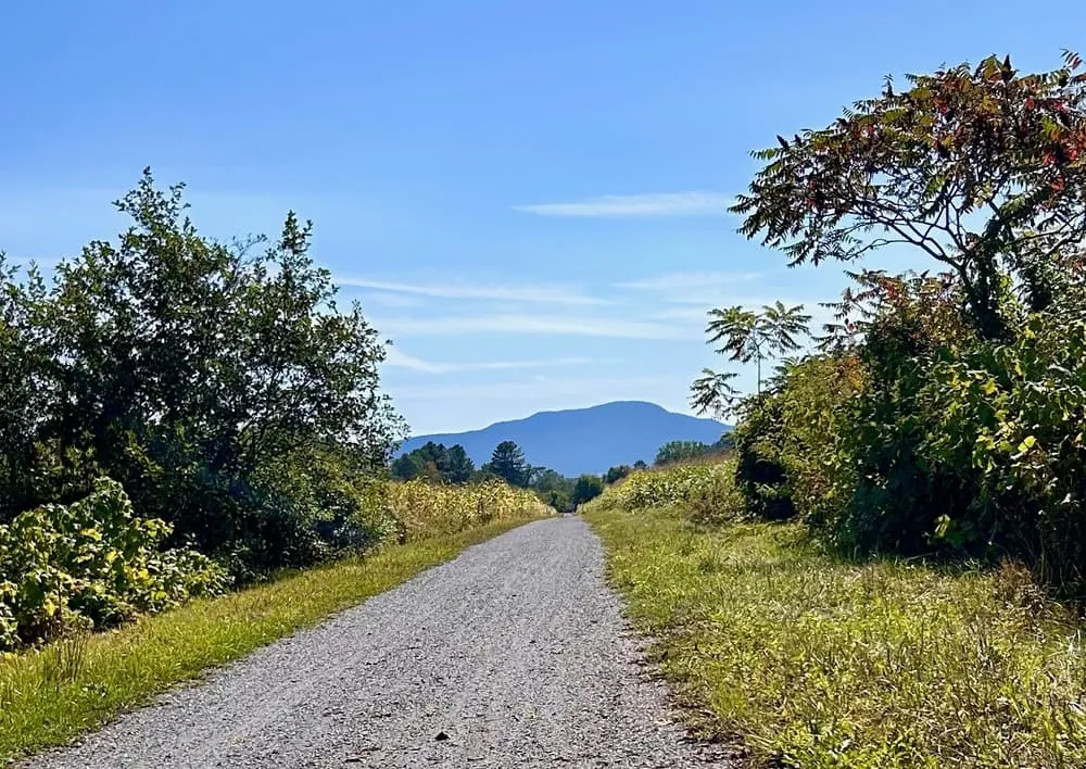
Riders traverse classic Vermont landscapes: sleepy farmland, high cornfields, winding rivers, wild river plains, rolling hills and mountain-backdrop scenery. The route weaves in and out of quaint villages, each with its own local flavor. Towns along the trail offer opportunities to explore art, local history, breweries, restaurants, shops, swimming holes, and quiet rural vibes. You can treat it as a relaxed day-ride, a multi-day journey, or anything in between.

History & Recent Developments

The LVRT was developed along the corridor of the old Lamoille Valley Railroad, giving the trail a historic backbone as a repurposed rail line.  2025 marks the first year the full trail is open without damage interruptions.

As local towns continue to adapt and build up infrastructure, the trail’s surrounding communities are gradually becoming more trail-friendly.

Difficulty Explained

Car-free, modest elevation gains, easy navigation and friendly locals give this route an easy difficulty rating.  Remoteness does add some logistical challenges but nothing a little pre-planning can't fix.

Interactive map showing the complete route. Green marker indicates start point, red marker shows the end point.

Local Businesses

Food/Drink

Red Barn Brewing (Danville, VT): Brewery in a barn setting with some kickass outdoor seating. Directly off the trail. 

Nacho Mama (Danville, VT): Nice mexican sit down joint. Directly off the trail. 

Caja Madera (Hardwick, VT): Taco Truck!!!!. Directly off the trail. 

Ten Bends Beer (Hyde Park, VT): Brewery with a nice selection of beer. 500ft east of trail. 

Soulmate Brewing Company (Morrisville, VT): Brewery is a true local hidden gem!. Directly off the trail. 

Two Sons Vermont (Hyde Park, VT): Cafe with drinks and baked goods.. 500 ft North of the trail. 

Two Sons Bakehouse (Hyde Park, VT): Fresh Bread and baked goods in addition to a full menu. 1000 ft north of trail. 

Robbie’s Wildlife Refuge (Jeffersonville, VT): Fun local bar with pool tables. Directly off the trail. 

Lodging

Vermont Freedom Campground (Greensboro Bend, VT): Campground for $30 for tent camping. Call ahead to reserve. Directly off the trail. 

Kimball House B&B (Hardwick, VT): Small Bed and Breakfast. Directly off the trail. 

Nye’s Green Valley Farm Bed and Breakfast and Vacation Rentals (Jeffersonville, VT): Homely Vermont Bed and Breakfast. Directly off the trail. 

Resources

Riverside Cycles (Hardwick, VT): Bikes, Gears, Services and Rentals!. Directly off the trail. 

Lamoille Valley Bike Tours (Johnson, VT): Bike shop dedicated to the Lamoille Valley Trail. In addition to selling bikes and E-Bikes, they offer a ton of services related to the Rail Trail. . Directly off the trail. 

Bootlegger Bikes – St Albans (St. Albans, VT): Bike shop with a ton of options and services. . Start of the Trail. 

Notable Sites + Highlights

  • Cabot – Famous for its Cabot Creamery which makes world-class cheese. Cabot village has a classic Vermont small-town feel.
  • Hardwick – A cultural stop with local breweries, farm-to-table restaurants, and community markets. Often a convenient resupply or lunch stop.
  • Johnson – A college town with a lively vibe, cafés, and historic Main Street. It’s also a natural break point mid-ride on the trail.

Logistics

Transportation To and From

  • To Start: St Johnsbury is not easily accessible with public transit. Car is your best optin.
  • To Finish: Swanton, on the other hand is more accessible via public transit.  St. Albans, which is about 5 miles south, has an Amtrak Train station which is served by the Vermonter line.  The Vermonter reaches major population centers in Massachusetts, Conn, and New York City!
  • From Finish to Start: There is no public option to get from start to finish, which is why this is listed as an Out and Back.  There are some private companies which offer a shuttle service so keep an eye out for these.
  • Important note! If you don't have access to a car or simply prefer public transit, I recommend starting in Swanton/St Albans.  From St. Albans there is another bike path that hits the trail in Sheldon Junction which is about 5 miles from Swanton.

Recommended Gear

  • Bike: Gravel, Touring or Mountain bike.  Road bikes are NOT recommended as it is a gravel path.
  • Clothing: This is a short enough ride that if you check the weather ahead you can plan accordingly.  That being said, I would always pack a piece of warm weather clothing to be on safe side.
    • In general, Vermont is a wetter than average climate so I'd bring a poncho at the very least.
  • Safety: Be visible; either with lights or reflective gear, especially on shared roads.  Also, having lights will be very useful when camping!
    • Bug Spray or tick repellant. This is tick country so if you camp bring some protection or at least ensure to do a tick check.
  • Camping: Tons of awesome camping spots along the way so I'd recommend planning some camping gear if you decide to go that route.  That being said, this is a relatively short trip, so you may not want to carry extra weight.
  • Tools: Multi-tool, spare tubes, patch kit, pump. This is critical on this route as it is remote and you don't want to have a flat-tire in the middle of nowhere!

Navigation

  • Signage: Trail is well signed with mile posts along the way to keep you aware.

Resources Along the Way

  • Lodging: Small inns/guesthouses in Vermont towns. Also plenty of campgrounds.
  • Food & Water: There are resources in towns about every 10 miles.  Just keep in mind that some of these towns are very small so don't always count on places being reliably open.  I'd always recommend carrying 20 miles worth of water.
  • Cell Signal: Very spotty in areas so ensure you are planning about 10 miles into the future. Re-evaluate plans when you reach towns with signal.

Tips

  • Best Seasons: Late spring through early fall (May–October) for best weather and road conditions.  Aiming for Fall Season is highly recommended!  April and November may have snow so do some research ahead.
  • Emergency Number (USA/Canada): 911 (+1 country code).

Important Warnings

Cell Signal can be an issue in this part of Vermont. Please ensure you understand where you are in the route in case you are in a situation where you may not be in cell signal range.
Weather can be an issue. Make sure to read the weather ahead of embarking on this route
This is tick country so bring either DEET, permethrin-treated clothing or at least do a manual check if you are in a high-risk area like a campground.

Route Details

Distance(Miles)

180 mi

Duration

3-5 Days

Elevation(ft)

1557

Countries

United States

Start/End Points

St Johnsbury, VT -> Swanton, VT

Route Format

Out and Back

Bike Lane Types

Bike Path
100%
Separated Bike Lane
Shared Lane

Tags

External Resources

Terms of Use: Cycling any route featured on this website is done entirely at your own risk. Before setting out, always check current route conditions, and any public or private land closures. While riding, obey all applicable laws, rules, and land-use restrictions, and ensure you carry appropriate safety and navigation equipment. The information provided on this site including route descriptions, maps,  and recommendations is intended solely as a planning and inspirational resource and should be used in conjunction with your own research, judgment, and due diligence. The accuracy, completeness, and suitability of the information, and the judgment of the author(s) cannot be guaranteed. Spokenlocal.com, its partners, affiliates, and contributors assume no responsibility or liability for personal injury, property damage, or any other incidents that may occur while riding or following any route featured on this website.