This is a great trail for people of ALL LEVELS! If you're new to biking, or like most people haven't touched a bike since you were 10, I'd highly recommend this route.
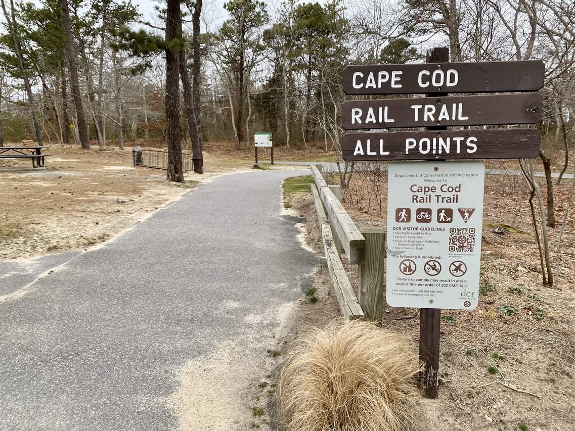
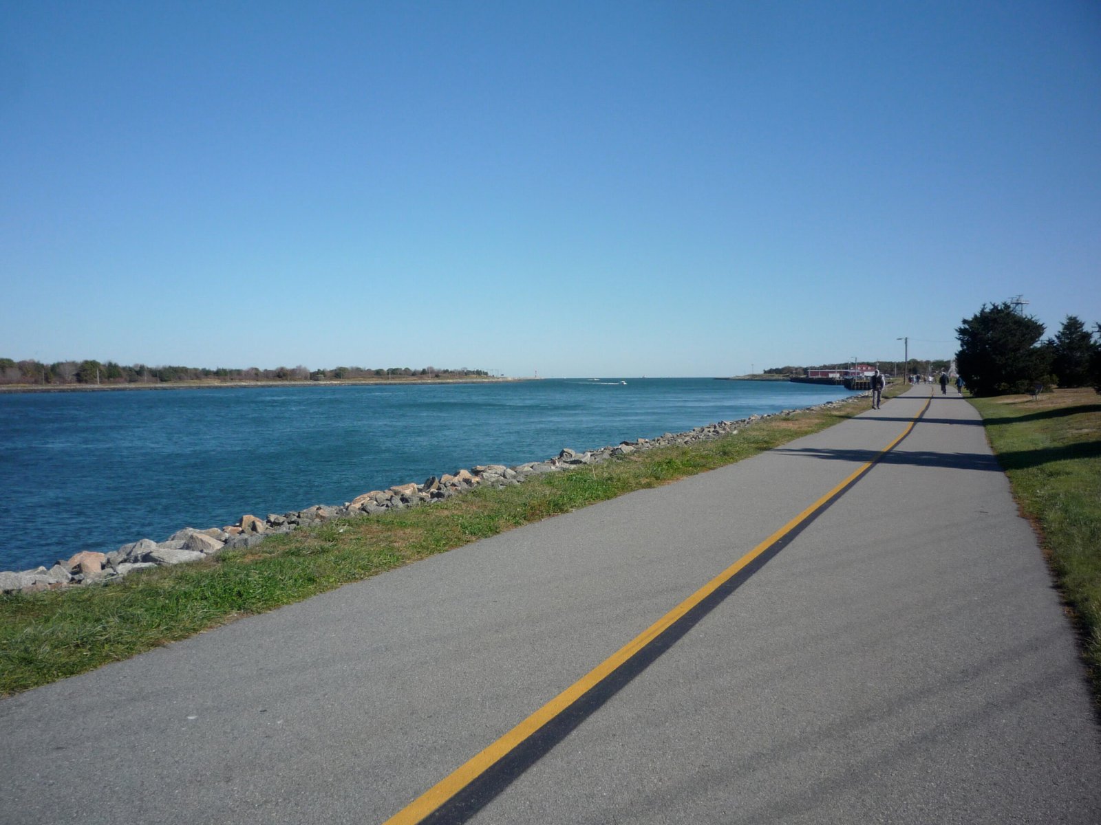
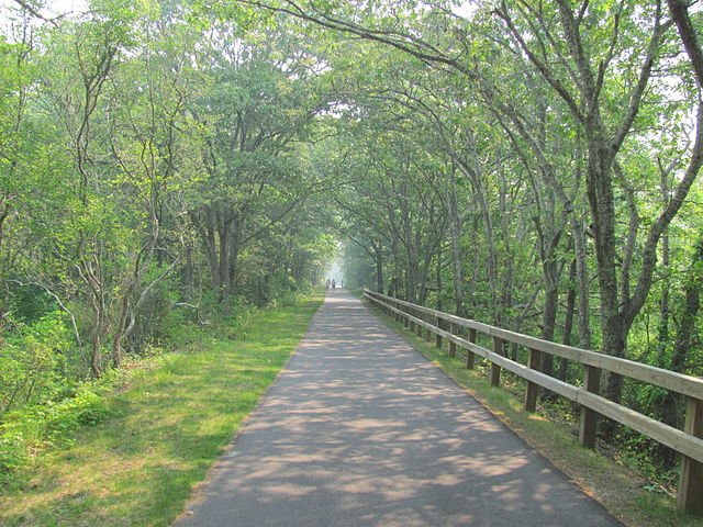
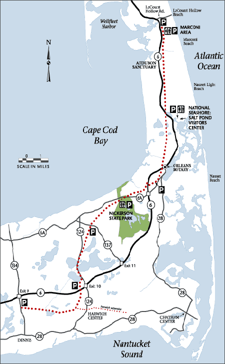
The Cape Cod Rail Trail is a 27 mile paved multi-use rail path that runs through the heart of Cape Cod, Massachusetts. It follows an old railroad corridor from South Dennis / Yarmouth north to South Wellfleet. It’s heavily used for cycling, walking, in-line skating, and horseback riding.
Cape Cod Rail Trail is mostly flat, car-free and paved with gentle grades and clearly marked crossings, making it ideal for most riders (families included).
This makes a great activity if you're ever spending a night in Cape Cod or looking for a quick day trip.
Notable towns along the way:
Hot Chocolate Sparrow (Orleans, MA): Cute Coffee Shop located right in town. Directly off the trail.
Nickerson State Park – Area 1 (Brewster, MA): State campgrund located close to the start. . .5 mile south of trail.
Wellfleet Hollow State Campground (Wellfleet, MA): State Campground at the end point. Directly end of the trail.
Barb’s Bike Shop (South Dennis, MA): Local bike shop with rentals. Directly off the trail.
Dennis Cycle Center (South Dennis, MA): Local shop with bike rental options. Directly off the trail.
Nickerson State Park – forested shade, kettle ponds, picnic spots, swimming, hiking and campgrounds.
Salt Pond Visitor Center (Cape Cod National Seashore) – exhibits, trails, and info about local ecology.
Wellfleet Bay Wildlife Sanctuary – birdwatching, boardwalks, and educational programs near Wellfleet.
Historic Cranberry Bogs – especially picturesque in fall harvest season.
Orleans – a bustling town center with dining, shopping, and local stores right near the trail.
Rock Harbor & Coast Guard Beach – accessible via short detours off the trail
55 mi
1-2 Days
1500
United States
Terms of Use: Cycling any route featured on this website is done entirely at your own risk. Before setting out, always check current route conditions, and any public or private land closures. While riding, obey all applicable laws, rules, and land-use restrictions, and ensure you carry appropriate safety and navigation equipment. The information provided on this site including route descriptions, maps, and recommendations is intended solely as a planning and inspirational resource and should be used in conjunction with your own research, judgment, and due diligence. The accuracy, completeness, and suitability of the information, and the judgment of the author(s) cannot be guaranteed. Spokenlocal.com, its partners, affiliates, and contributors assume no responsibility or liability for personal injury, property damage, or any other incidents that may occur while riding or following any route featured on this website.