Overview

If you’re looking for the perfect blend of scenery, culture, and safety, look no further than the Adige River Bike Path. Cutting through the heart of Northern Italy and the edge of the Dolomites, this stunning route feels like riding through a postcard, with dramatic Alpine backdrops, vineyards, and storybook towns around every bend. Thanks to its extensive network of separated bike paths and quiet roads, it’s a route that’s accessible to riders of nearly all levels.

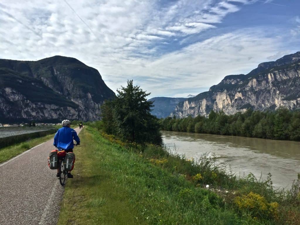
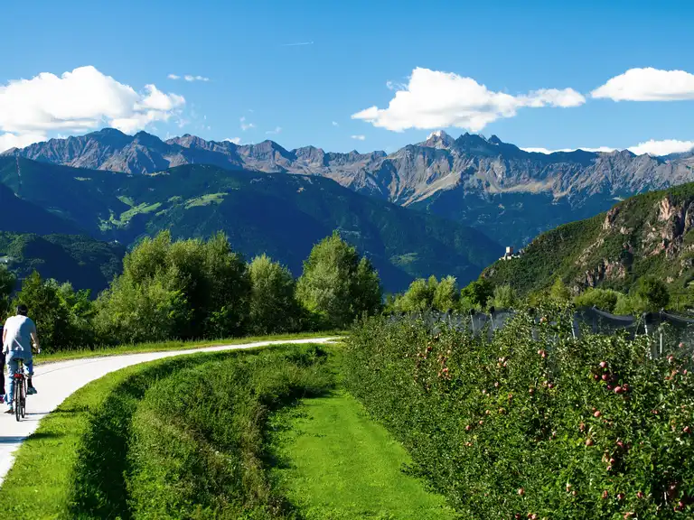
The path roughly follows the historic Via Claudia Augusta, an ancient Roman and medieval trade route that once connected the Alps to the Italian plains. Later reused by railways and modern highways, this corridor created a wide, gentle valley perfectly suited for cycling today. As a result, the route is largely flat, well-developed, and predominantly paved, with only occasional short gravel sections.

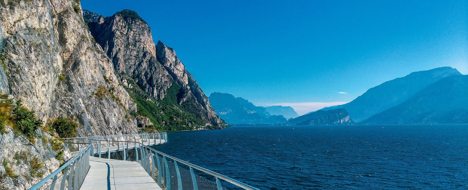
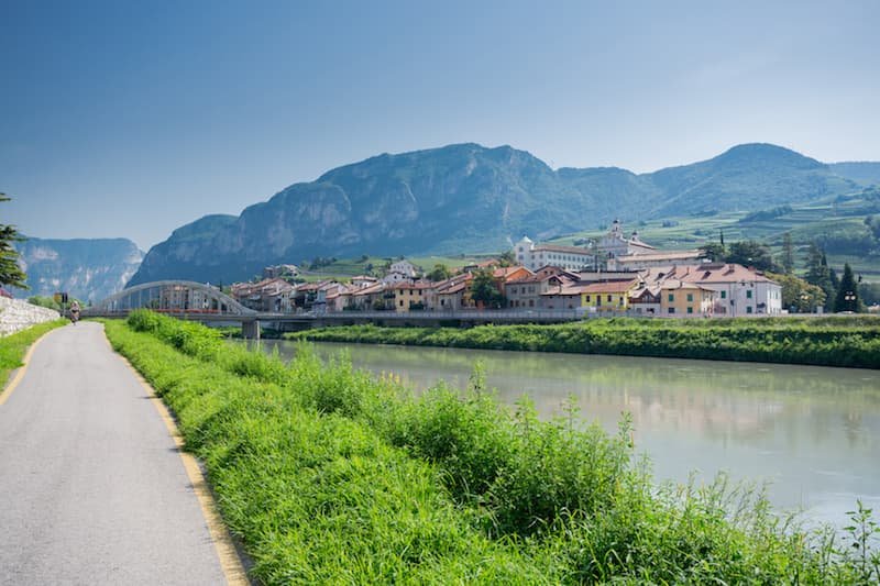
Following Italy’s second-longest river, the Adige, the route stretches from the Alpine north near the Austrian border and Lake Reschen, through South Tyrol and Trentino, and all the way to Verona. Along the way, cyclists pass through culturally rich cities such as Bolzano, Trento, and Verona, where history, food, and wine are never far from the trail.

Difficulty Explained:

Safe bike paths, tons of resources along the trail and easy public transit make this a perfect route for people of all levels; especially those looking for their First Tour!

Reschen to Verona (Italy)

Interactive map showing the complete route. Green marker indicates start point, red marker shows the end point.

Local Businesses

Food/Drink
Suggest Local Businesses
Lodging
Suggest Local Businesses
Resources
Suggest Local Businesses

Notable Sites + Highlights

Northern Section

  • Reschen & Lake Resia (Reschensee)- Famous for the submerged church tower rising from the lake, a compelling photo stop near the Swiss/Austrian border.
  • Merano (Meran)- Elegant spa town with thermal gardens, promenades, cafés, and historic town center. Great for rest and local cuisine.
  • Bolzano (Bozen)- Capital of South Tyrol. Stroll the medieval old town, visit markets, historic architecture, and optional museums.
  • Castle Firmiano / Messner Mountain Museum- Just off the path near Bolzano — a striking hilltop castle housing part of Reinhold Messner’s museum project.

Central Trentino Section

  • Piana Rotaliana & Vineyards- Rolling vineyards and orchards near San Michele all’Adige, Grumo, and Lavis; ideal for sips of Teroldego wine or local fruit stops.
  • Trento- A major cultural hub:
    • Buonconsiglio Castle with its art and history exhibits.
    • Piazza Duomo and the Renaissance historic center.
    • Museums and cafés make it an excellent overnight stop.
  • Small Town Detours- Mezzolombardo, Mezzocorona, Nave San Rocco; charming small towns with local wineries and eateries.

Southern Trentino and Veneto Section

  • Castel Beseno- South of Trento, a remarkable medieval fortress perched atop a hill,  great panoramic view and history stop.
  • Rovereto- Historic town with museums (including MART modern art) and a lively center.
  • Small Towns like Mori, Ala, Isera, Villa Lagarina
  • Torbole / Riva del Garda- On Lake Garda’s northern edge — end your ride with stunning lake views and water-side dining.

Logistics

Transportation To & From

  • To Start (Reschen): There is a train that runs from Verona to Reschen and passes thru the following towns:  Merano, Bolzano, Trento, Rovereto, Verona.
  • Along the Path: The Brenner railway line runs parallel to the route. Regional trains accept bikes (bike ticket required). Easy one-way rides with train return are common.
  • To End (Verona): Verona is a much bigger city with ample transit options, including Train(Recommended, Bus, and Plane).
  • Finish to Start : Trains are frequent between Verona ↔ Bolzano ↔ Trento.

Recommended Gear

  • Recommended Bike Type- Touring bike, Gravel bike (35–45 mm tires ideal), Hybrid / trekking bike, E-bike (charging widely available).
  • Less than ideal Bike Types-
    • Do Not Recommend Skinny-tire road bikes due to some gravel sections, but it's possible if you are careful to avoid them.
    • Mountain Bikes may be overkill and will slow you down but is totally possible.
  • Camping (Optional)
    • There are numerous campsites along this route so if you want to save some money and sleep under the stars, do it!

Navigation

  • Signage is excellent along the path Marked as:
    • Ciclabile dell’Adige
    • Via Claudia Augusta

Resources Along the Way

Lodging

  • Hotels, B&Bs, guesthouses in nearly every town
  • Bike-friendly accommodations common
  • Agriturism (farm stays) in rural sections
  • Campsites almost every 15 km.

Food & Water

  • Cafés, bakeries, supermarkets in most towns
  • BiciGrill bike cafés directly on the path
  • Public water fountains common in Trentino & South Tyrol

Remoteness & Cell Signal

  • Route is never truly remote
  • Reliable cell coverage almost everywhere
  • Emergency services easily reachable

Local Notes

Best Time to Go

  • Ideal seasons: May–June + September–early October
  • Summer (July–August): Can be hot in valleys + Busy with cyclists and tourists

Festivals & Events

  • Wine harvest festivals (September)
  • Local town festivals throughout summer
  • Christmas markets (off-season cycling only in southern sections)

Tips for a Great Ride

  • Emergency number (Italy & EU): 112. Country code: +39

Important Warnings

Mountain weather can change very rapidly. Be aware of weather when on the trail and just make sure you are close to a shelter point.

Route Details

Distance(Miles)

195 mi

Duration

3-5 Days

Elevation(ft)

3000

Countries

Italy

Start/End Points

Reschen, Italy -> Verona, Italy

Route Format

Point to Point

Bike Lane Types

Bike Path
80%
Separated Bike Lane
10%
Shared Lane
10%

Tags

External Resources

Terms of Use: Cycling any route featured on this website is done entirely at your own risk. Before setting out, always check current route conditions, and any public or private land closures. While riding, obey all applicable laws, rules, and land-use restrictions, and ensure you carry appropriate safety and navigation equipment. The information provided on this site including route descriptions, maps,  and recommendations is intended solely as a planning and inspirational resource and should be used in conjunction with your own research, judgment, and due diligence. The accuracy, completeness, and suitability of the information, and the judgment of the author(s) cannot be guaranteed. Spokenlocal.com, its partners, affiliates, and contributors assume no responsibility or liability for personal injury, property damage, or any other incidents that may occur while riding or following any route featured on this website.