Farmington Canal Bike Path (MA,CT-USA)

Small towns, easy path, tons of history. Enjoy this New England bike path across Connecticut

Overview

Wanna tell your friends you biked across a state in a day (or 2)? This is an amazing option if you are new to bike touring and want to get your feet wet.  The trail is flat and on an exclusively separated path (Except for a small 5 mile section).

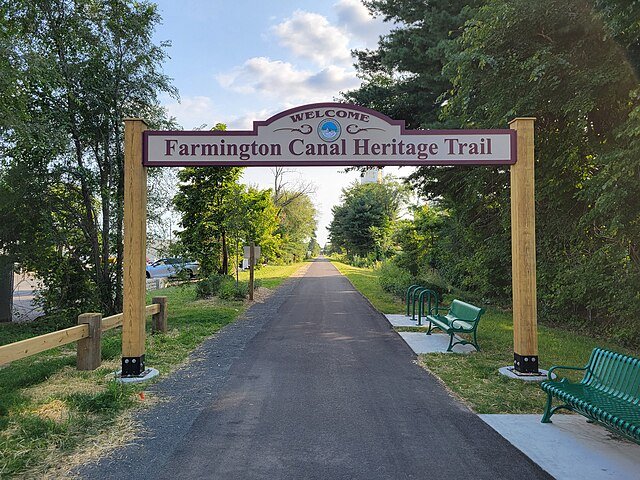
The Farmington Canal Bike Path, officially known as the Farmington Canal Heritage Trail (FCHT), is a prominent paved multi-use pathway stretching from New Haven, Connecticut, northward to the Massachusetts town of Westfield, MA. It offers a scenic, mostly flat route for cyclists, walkers, runners, and other non-motorized users, linking a variety of urban, suburban, and rural landscapes rich in history and natural beauty.

Difficulty Explained

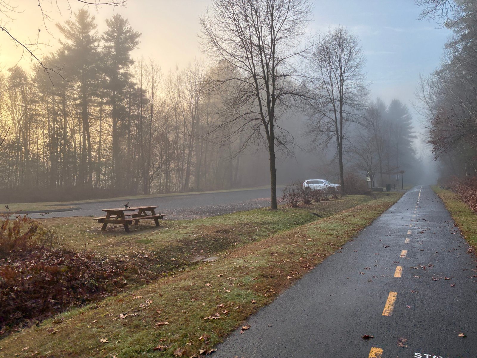
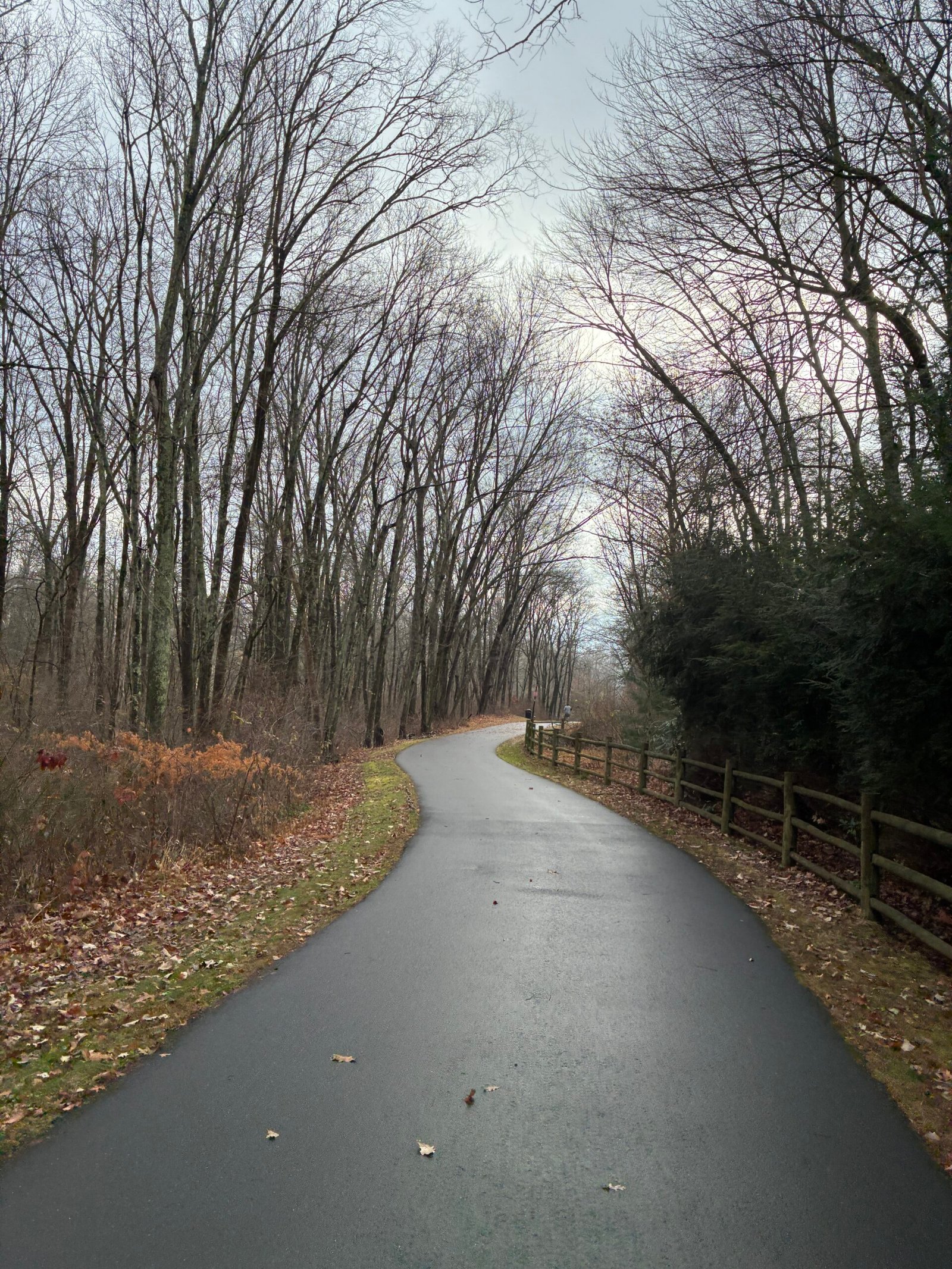
This trail is primarily on separated bike path with limited elevation gains.  Weather is very predictable along the entire path. The entire route is near to resources.  Signage is very simple to follow.  The trail is very well-travelled in case you run into any issues.

Notable Towns along path (From North to South):

  • Westfield, MA
  • Simsbury, CT
  • Avon, CT
  • Plainville, CT
  • Cheshire, CT
  • Mount Carmel, CT
  • New Haven, CT

Route Map

Interactive map showing the complete route. Green marker indicates start point, red marker shows the end point.

Local Businesses

Food/Drink

Congamond Cafe (Southwick, MA): Supercute cafe that’s directly off the bike path on the CT/MA border. Can’t miss it . Directly off the trail. 

Mikro Depot Brewery (Hamden, CT): Brewery 10 miles north of New Haven. Great spot to kick back and enjoy the last remaining stretch of the trail. Directly off the trail. 

Funcle’s Cafe (Hamden, CT): Homely cafe right off the trail offering typical American fair and friendly environment. . Directly off the trail. 

Mamouns (New Haven, CT): Awesome mideastern spot! . Directly off the trail. . 

Lodging
Suggest Local Businesses
Resources

The Bicycle Cellar (Simsubury, CT): Helpful bike shop right on the trail. Can’t miss the signs!. Directly off the trail. 

Rosedale Farms & Vineyards (Simsubury, CT): Large selection of local produce, wine, cheese and bakery items.. About .25 miles east of trail. 

Mel’s Bike Rentals LLC (Southington, CT): Great place for bike rentals in case you don’t have your own bike. . Directly off the trail. 

Cheshire Cycle & Repair (Cheshire, CT): Great spot for bike repair services for reasonable prices. Directly off the trail. 

Notable Sites + Highlights

Listed in the direction from New Haven to Westfield
  • Yale University(New Haven, CT) - One of the most prestigious and gorgeous college campuses
  • Quinnipiac University(Hamden, CT) - Well known for
  • Sleeping Giant Observation Tower(Mt. Carmel, CT) - Pretty cool tower on top of a very steep hill. Gorgeous views of the surrounding area. Located about 10 miles from New Haven.
  • Talcott Mountain State Park (Avon, CT) - Gorgeous hiking path slightly off the trail in the town of Avon.  It's an easy hike and you'll be treated with a pretty cool castle on top. If you're planning a 2 day trip, this makes an awesome detour!

Logistics

Transportation to and from

  • To Start: Driving and parking is very easy at the trailhead in Westfield. If you prefer/require public transit it is totally possible. Westfield, MA is about 8 miles west of Springfield, MA, which is another major artery.  From Springfield you can take the R10 bus which drops directly on the trail and is bike friendly.
  • To End: New Haven, CT is a major hub with multiple train/bus lines connecting most major areas in the Northeast region.
  • Finish to Start: If you are looking to do a 1-way trip, there are several daily trains that run between Springfield and New Haven (Amtrak or CTRail) and they are all bike-friendly.

Recommended Gear (type of Bike, clothing, camping, etc)

  • Bike: Any type of bike will suffice on this trail.  Everything is paved.
  • Clothing should be weather-appropriate. Given it is such a short trail, check the weather forecast ahead and plan accordingly.
  • I don't recommend camping as it will just add to your complexity and there are not many if any options.

Navigation (Signage, Direction)

  • Signage is very easy and obvious along the trail in both directions.  There is no strong prevailing wind directions or large elevation gains that give either direction an advantage.  My preference is to end in New Haven, CT since it is a way more bustling end point compared to Springfield.
  • There is a 5 mile break in the trail in Plainville, CT (About the halfway point).  During this break, the bike path disappears and you will have to share the road with cars, or bike on the sidewalk if you prefer.

Resources along the way

  • The Northeast is one of the most densely populated areas in the US.  You will never be too far from any resource or cell signal.
  • You will pass a notable town with food about every 10 miles at most.

Local Notes

  • Fall Colors is the most stunning time to visit.  Spring and Summer are also very great times to go.  Since it is mostly tree-lined path, even sweltering summer days aren't too bad.  Winter is totally possible, just be wary of any ice along the path.

Tips

  • Emergency Number (USA/Canada): 911 (+1 country code)

Important Warnings

⚠️ The only section to be wary of is a ~5 mile stretch in Plainville, CT where there is a break in the trail. In this section you will need to either use a shared bike lane or sidewalk if you feel more comfortable.
⚠️ Strong headwinds can be something to keep an eye out for. If you are planning a tight schedule, just keep in mind that these winds can sometimes slow down those plans. You can use nice resources like WindFinder to give you a great idea of wind forecasts.
⚠️ Beyond that, this is a very welcoming trail for people of all levels.

Route Details

Distance(Miles)

70 mi

Duration

1-2 Days

Elevation(ft)

1700

Countries

United States

Start/End Points

Westfield, MA -> New Haven, CT

Route Format

Point to Point

Bike Lane Types

Bike Path
90%
Separated Bike Lane
Shared Lane
10%

Tags

External Resources

Terms of Use: Cycling any route featured on this website is done entirely at your own risk. Before setting out, always check current route conditions, and any public or private land closures. While riding, obey all applicable laws, rules, and land-use restrictions, and ensure you carry appropriate safety and navigation equipment. The information provided on this site including route descriptions, maps,  and recommendations is intended solely as a planning and inspirational resource and should be used in conjunction with your own research, judgment, and due diligence. The accuracy, completeness, and suitability of the information, and the judgment of the author(s) cannot be guaranteed. Spokenlocal.com, its partners, affiliates, and contributors assume no responsibility or liability for personal injury, property damage, or any other incidents that may occur while riding or following any route featured on this website.