Thinking about your first mini weekend bike tour? The Le P'tit Train du Nord could be one your best options for so many reasons. It is a perfect blend of gorgeous scenery, charming local towns, and easy + safe + car-free paths. With ample resources along the trail, you don't need a whole lot of gear or logistics to bog you down. Not to mention the option of taking a shuttle to the start/end point if you just want to make it a 1-way trip!
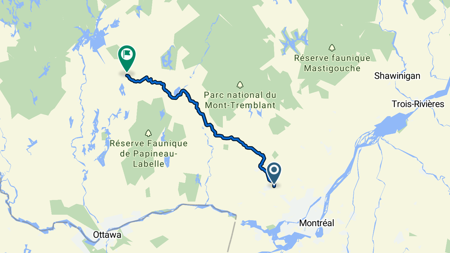
Le P’tit Train du Nord is a multi-use rail-trail and linear park in the Laurentian region of Québec. The trail runs approximately 230km (~140 miles) from Saint-Jerome in the south to Mont-Laurier in the north. It follows the corridor of a former railway. After rail service ended, the corridor was transformed into this bike-friendly linear park which was officially completed in 1996. Today it’s part of the wider regional and national trail networks (including segments connected to the broader major routes) and supports cycling, hiking, and cross-country skiing depending on season and segment.
This is a perfect 1st time route if you're looking to get into bike touring. The route is entirely car-free with gentle elevation gains. Logistics are a breeze because:
Merci la Vie (PIedmont, QC): Cute bakery. Across the river.
Le Général Café (Val-David, QC): Super cute cafe. Directly off the trail.
Ayawan – Brasserie Artisanale (Val-Morin, QC): Artisan Brewpub. 1000 ft south of the trail.
La Veillée – Microbrasserie & Pub (Sainte Agathe Des Monts, QC): Microbrew with some nice eats. Directly off the trail.
Le P’Tit Stop (Mont-Blanc, QC): Cute burger joint serving bike riders. Directly off the trail. .
Charlotte café (Mont Tremblant, QC): Warm, cosy option with a fireplace serving breakfast & lunch fare such as eggs, salads & sandwiches.. Directly off the trail.
Cucinotto (Mont Tremblant, QC): Awesome local cafe in the beautiful Mont Tremblant valley. Directly off the trail.
Lab crémerie café (Labelle, QC): Cute cafe with a nice outdoor seating area. Directly off the trail.
Le Petit Café du Nord (Nominingue, QC): Cafe which caters to cyclists along the route. Directly off the trail.
Camping Labelle et la Rouge (Labelle, QC): Campground – $50. Directly off the trail.
TechnOlodge (PIedmont, QC): Bike repair shop. Across the river.
Les SurVoltés inc. (Val-David, QC): Les SurVoltés inc.. Directly off the trail.
Cybercycle inc. (Mont Tremblant, QC): Bike shop and repair. Directly off the trail.
Sports Experts (Riviere-Rouge, QC): Bike shop and outdoors store. Directly off the trail.
150 mi
3-5 Days
1500
Canada
Terms of Use: Cycling any route featured on this website is done entirely at your own risk. Before setting out, always check current route conditions, and any public or private land closures. While riding, obey all applicable laws, rules, and land-use restrictions, and ensure you carry appropriate safety and navigation equipment. The information provided on this site including route descriptions, maps, and recommendations is intended solely as a planning and inspirational resource and should be used in conjunction with your own research, judgment, and due diligence. The accuracy, completeness, and suitability of the information, and the judgment of the author(s) cannot be guaranteed. Spokenlocal.com, its partners, affiliates, and contributors assume no responsibility or liability for personal injury, property damage, or any other incidents that may occur while riding or following any route featured on this website.