This ride is perfect for cyclists looking for a remote gravel adventure with gentle rail-trail grades and expansive natural scenery. The trail’s length, loose gravel sections, and remote stretches make it best suited for gravel riders, bikepackers, or touring cyclists seeking solitude.
This ride comprises of 2 distinct sections:
1. Bar Harbor to Ellsworth (25 mi)
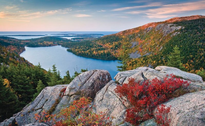
Note that this section is totally optional! You will be sharing the road with vehicles on mostly quiet roads but will be greeted by absolute beauty in Acadia National park. If you choose not to bike this section, I'd still highly recommend you find a way to visit Acadia as it is one of the premier national parks on the East Coast.
2. Ellsworth to Perry via Sunrise Trail (90 mi)
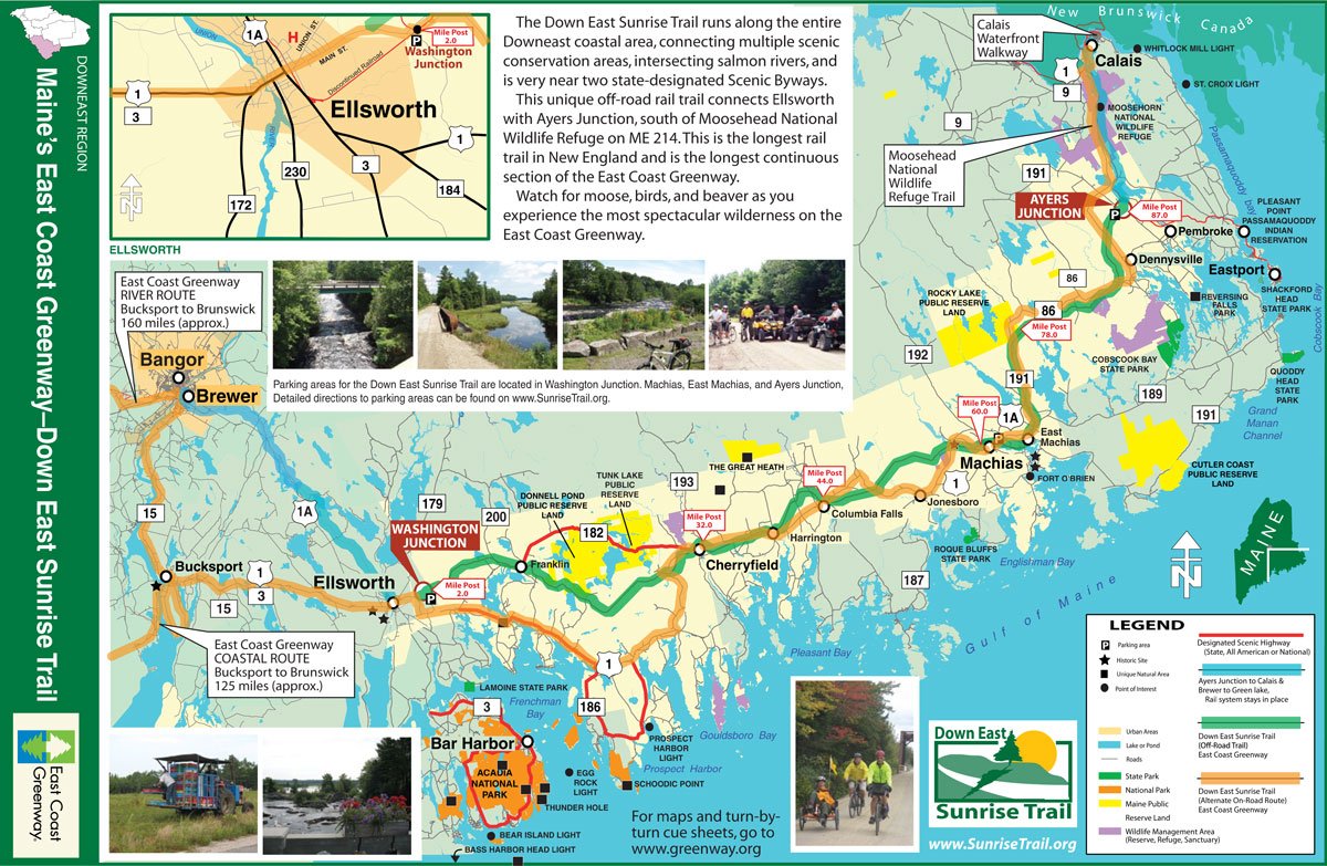
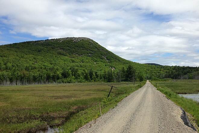
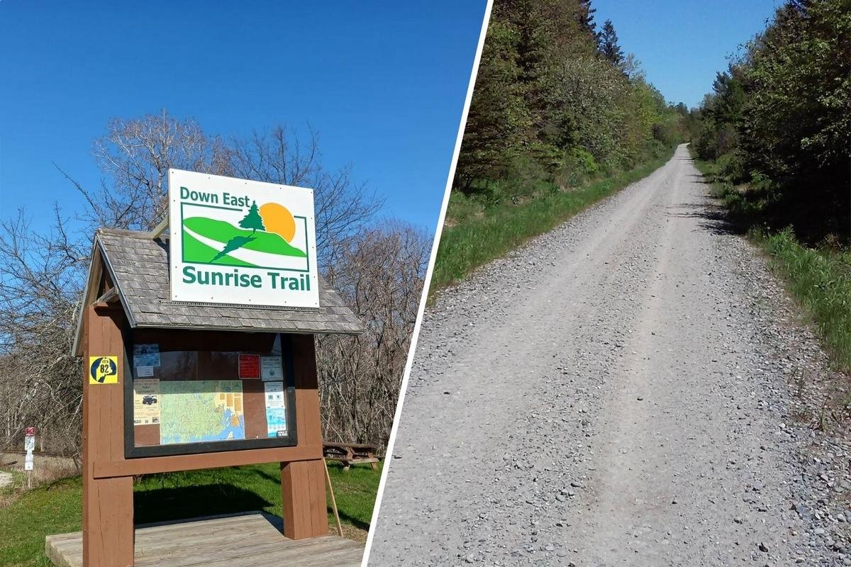
The Down East Sunrise Trail follows the historic Calais Branch railroad corridor through forests, marshlands, rivers, and small fishing towns. The line originally carried freight and passengers beginning in the late 1800s before rail service declined and the corridor was converted into a recreational trail.
Today the trail connects Ellsworth to Ayers Junction near the Canadian border and forms the longest continuous off-road segment of the East Coast Greenway, a developing cycling route stretching from Maine to Florida.
Riding the Sunrise Trail feels like stepping into Maine’s quieter side. You’ll pass blueberry barrens, salt marshes, salmon rivers, and dense pine forests while occasionally rolling through small Down East communities like Cherryfield and Machias. Wildlife sightings—including deer, eagles, and even moose—are common.
3. (Optional Extension) Perry to Moose Island (5 mi)
The town of Perry is very small and does not offer a ton of resources. A great and very scenic option is to extend the route about 5 miles onto the popular Moose Island. Moose Island has a ton of lodging and food options. Fun Fact! Eastport Maine, on Moose Island) is the Easternmost city in the United States!Difficulty Explained
Since this is a rail-trail, there are no significant elevation changes. Also, the Sunrise Trail portion is very established and well-signed. I rated this Moderate Due to the remote nature, surface type and tricky section between Bar Harbor to the start of the Sunrise Trail.
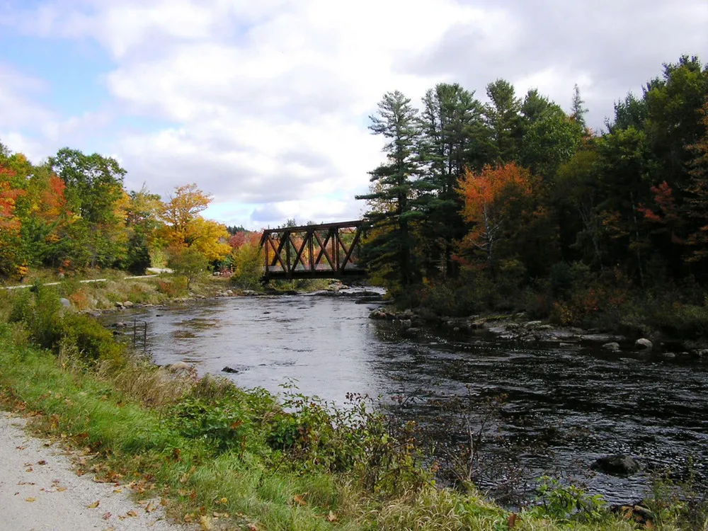
Machias River crossings and salt marsh views
Cherryfield – “Wild Blueberry Capital of the World”
Narraguagus River bridge
Schoodic Bog wetlands
Schoodic Mountain views
Blueberry barrens and coastal forests
Wildlife sightings (moose, deer, eagles, beavers)
240 mi
3-5 Days
3800
United States
Terms of Use: Cycling any route featured on this website is done entirely at your own risk. Before setting out, always check current route conditions, and any public or private land closures. While riding, obey all applicable laws, rules, and land-use restrictions, and ensure you carry appropriate safety and navigation equipment. The information provided on this site including route descriptions, maps, and recommendations is intended solely as a planning and inspirational resource and should be used in conjunction with your own research, judgment, and due diligence. The accuracy, completeness, and suitability of the information, and the judgment of the author(s) cannot be guaranteed. Spokenlocal.com, its partners, affiliates, and contributors assume no responsibility or liability for personal injury, property damage, or any other incidents that may occur while riding or following any route featured on this website.