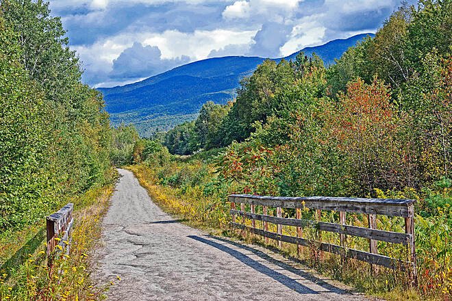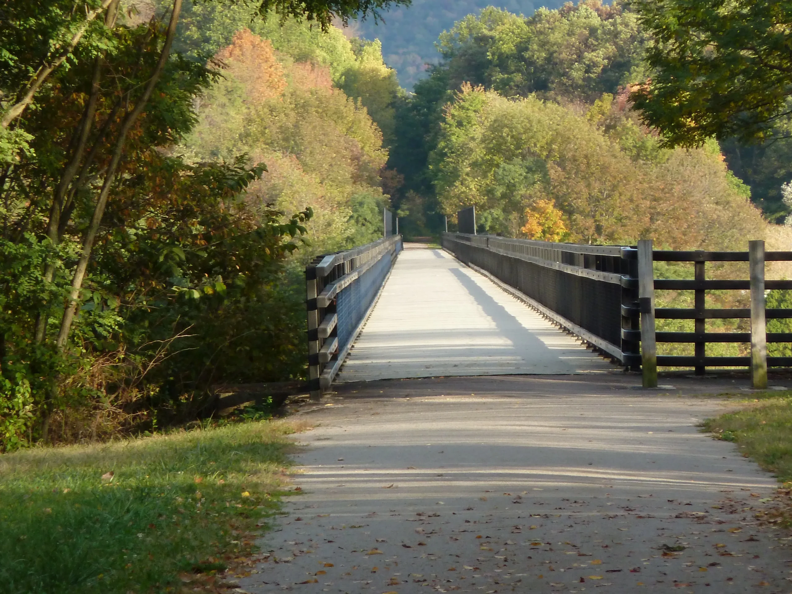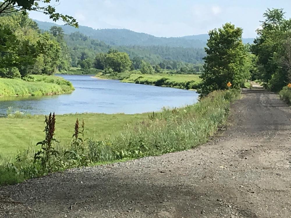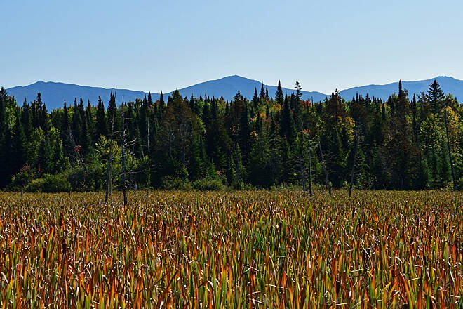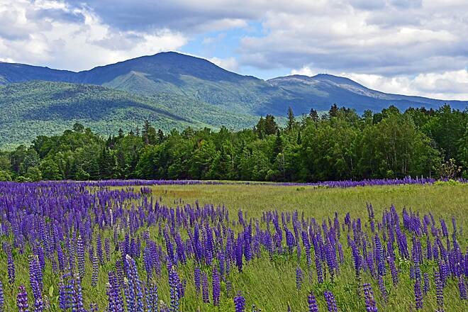
This rail trail stretching roughly from Woodsville, NH to Berlin offers one of the most remote and peaceful rail-trail experiences in New England. If you're looking for some stunning scenery, this might take the cake! This part of New England is one of the most gorgeous parts you're likely to encounter, and this route is the perfect way to experience it. Tucked away from most major roads, these trails will allow you to soak in the nature while feeling the intricacies of the land. Beats being in a car!!
This particular route consists of 3 distinct and roughly equal sections.
I am personally torn with this rating and could easily see it going either way.
What makes it Easy?
What makes it Moderate?
Wildflour Cafe (Lisbon, NH): Awesome little bakery that provides a hearty breakfast to fuel your ride. Directly off the trail.
Schilling Beer Co. (Littleton, NH): Awesome brewery right on the river with great food and beer. Great spot for a break. . Directly off the trail.
Sunny & Jillians Pizza & Pub (Whitefield, NH): Self-explanatory place but with great outdoor seating. In town.
Big Day Brewing (Gorham, NH): Great spot close to the end to enjoy a beer and some good eats. . 1 mile east of trail.
Core Shot Coffee Bar (Gorham, NH): Highly rated coffee shop that also sells some outdoor gear. Across the river.
Israel River Campground (Jefferson, NH): Great private campground that caters to cyclists of the trail trail. Directly off the trail.
Valley Way Tentsite (Mt. Adams, NH): If you’re into Free wild camping, and going to attempt a hike, this could be for you. . 2 miles into Mt Adams Hike.
Moose Brook State Park (Gorham, NH): State park with Campgrounds. Directly off the trail.
The Gear Library (Littleton, NH): Amazing little non-profit that has gear people can borrow for free. Check out the website for more details and consider donating if you love the cause. . 2 miles from trail.
Crooker Cycle Sports (Berlin, NH): Bike shop at the end of the Trail. Directly off the trail.
This is a fairly remote part of the state so you will definitely need a car to get you to the starting point. As such, there is no way to get from the end to the start, so this is classified as an Out and Back
Bike Type
This trail, except for the road section is entirely gravel and crushed rock. Road Bikes are NOT recommended. Highly recommend a Gravel bike, XC hardtail MTB, or Bikepacking setup for multi-day
Clothing
Camping
There's a ton of camping along the route. Recommend a light-weight camping setup.
Other
Lodging
Food & Water
Best Seasons
Avoid
120 mi
1-2 Days
2500
United States
Terms of Use: Cycling any route featured on this website is done entirely at your own risk. Before setting out, always check current route conditions, and any public or private land closures. While riding, obey all applicable laws, rules, and land-use restrictions, and ensure you carry appropriate safety and navigation equipment. The information provided on this site including route descriptions, maps, and recommendations is intended solely as a planning and inspirational resource and should be used in conjunction with your own research, judgment, and due diligence. The accuracy, completeness, and suitability of the information, and the judgment of the author(s) cannot be guaranteed. Spokenlocal.com, its partners, affiliates, and contributors assume no responsibility or liability for personal injury, property damage, or any other incidents that may occur while riding or following any route featured on this website.